Executive Overview
In a surprising and aggressive bid to reclaim relevance in a market dominated by tech giants, the classic navigation pioneer MapQuest has rolled out a feature that changes how everyday citizens interact with their local geography. Amid a broader modernization effort—which has recently included the introduction of Android Auto integration, public transit routing, and a celebrated stance against politically motivated geographic renaming—MapQuest has launched a dedicated mapping layer that displays the precise locations of outdoor surveillance hardware and Automated License Plate Readers (ALPRs).
This new capability allows users to toggle a specialized view within the MapQuest application to expose known camera installations across their neighborhoods and commutes. Rather than focusing solely on traffic flow, accidents, or optimal routing, MapQuest is now actively shedding light on the invisible infrastructure of mass surveillance. By mapping hardware manufactured by industry leaders such as Flock Safety, Motorola Solutions (Vigilant), Genetec, Axis Communications, Axon, Leonardo (ELSAG), Neology, Rekor, PlateSmart, Ubicquia, and Verkada, the platform has thrust the conversation surrounding public privacy and municipal monitoring directly into the mainstream.
This development arrives at a critical juncture in the debate over public safety versus civil liberties. As municipal police departments, private homeowners associations, and commercial enterprises increasingly blanket suburban streets and urban corridors with networked optical sensors, public pushback has steadily mounted. MapQuest’s implementation does not promise to help drivers evade these lenses, nor does it serve as an active countermeasure. Instead, it acts as an eye-opening educational tool—a digital cartography of modern observation that quantifies just how densely monitored our public spaces have become.
Detailed Chronology: MapQuest’s Unlikely Resurgence
To understand the context of MapQuest’s surveillance-tracking feature, one must examine the platform’s recent, highly unusual trajectory. Long relegated to the history books of early internet culture as the punchline of a bygone era of print-at-home driving directions, MapQuest has executed a calculated and surprisingly aggressive operational pivot.
The Turning Point: The Great Cartographic Stand
The catalyst for MapQuest’s recent surge in public interest began with a geopolitical and cultural quirk involving geographic nomenclature. While industry heavyweights like Google Maps and Apple Maps made sweeping, localized concessions by altering the designation of Lake Ontario to "Lake America" for users within the United States, MapQuest took a radically different stance. Refusing to bend to domestic renaming pressures, MapQuest retained the traditional, internationally recognized designation. This stubborn adherence to cartographic convention struck a chord with a public increasingly fatigued by corporate algorithmic conformity. The app experienced an immediate, unexpected surge in downloads and daily active users, providing the brand with a newfound reservoir of consumer goodwill.
Modernizing the Core Experience
Capitalizing on this unexpected wave of publicity, MapQuest’s engineering teams quickly accelerated a backlog of long-overdue feature updates. For years, the platform had suffered from a reputation as an archaic web tool incapable of competing with the smartphone-native ecosystems of Apple and Google.
- Android Auto Integration: MapQuest finally bridged the gap between desktop planning and in-dash vehicular displays, rolling out robust Android Auto support to capture drivers utilizing modern infotainment systems.
- Public Transit Directions: In a move that left many industry analysts bewildered as to why it took until the mid-2020s, MapQuest introduced comprehensive public transit routing options, allowing urban commuters to plan multi-modal journeys involving buses, subways, and trains.
- The Surveillance Layer: Building upon this modernization spree, the company introduced its most provocative feature yet: an interactive overlay designed to expose the physical footprint of public and private optical surveillance arrays.
Announced via a tongue-in-cheek social media campaign featuring a short video set to Rockwell’s classic 1984 paranoia anthem "Somebody’s Watching Me," the surveillance layer instantly differentiated MapQuest from every other major navigation app on the market. Positioned neatly alongside standard map layers like traffic alerts and incident reports, the tool represents a profound philosophical shift: treating surveillance infrastructure not as an invisible backdrop, but as a critical element of the physical landscape that road users have a right to see.
Supporting Context & Metrics: The Expansion of Flock Safety and ALPR Networks
To fully appreciate the utility and impact of MapQuest’s new feature, one must examine the staggering proliferation of the technology it aims to map. At the center of this ecosystem is Flock Safety, a private surveillance company whose growth over the past half-decade has completely transformed neighborhood security dynamics across North America.
The Rise of Flock Safety
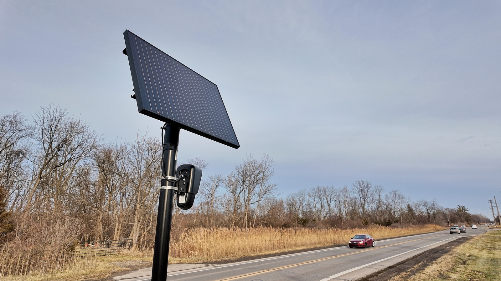
Founded in 2017, Flock Safety initially pitched its product as a simple, solar-powered camera system designed to capture objective evidence of property crimes and vehicle thefts in suburban neighborhoods. Utilizing machine learning algorithms and optical character recognition (OCR), Flock’s fixed-position, pole-mounted cameras capture the license plates, make, model, color, and distinguishing features of every passing vehicle, regardless of whether the driver is suspected of a crime.
This data is instantly cataloged, uploaded to a cloud-based repository, and cross-referenced against law enforcement hotlists—such as the National Crime Information Center (NCIC)—in a matter of seconds. Furthermore, Flock’s software allows police departments to share data across municipal and state boundaries, creating a sprawling, interconnected grid of vehicular movement tracking.
Market Dominance and Industry Competitors
While Flock Safety has dominated headlines due to its aggressive expansion into suburban HOAs and municipal contracts, it is far from the only player in the automated surveillance market. MapQuest’s new mapping layer accounts for this industrial diversity by incorporating hardware from a wide array of manufacturers:
- Motorola Solutions (Vigilant Solutions): A legacy giant in law enforcement technology, Vigilant boasts billions of historical license plate records, pooling data from both dedicated fixed cameras and mobile, cruiser-mounted plate readers.
- Genetec & Axis Communications: Major players in enterprise-grade physical security, providing high-definition pan-tilt-zoom (PTZ) cameras and intelligent video management systems used by both municipalities and private enterprises.
- Axon Enterprise: Best known for police body cameras and TASERs, Axon has increasingly moved into the automated fleet and fixed-site surveillance space, integrating video feeds directly into evidence-management ecosystems.
- Leonardo (ELSAG) & Neology: Global specialists in tolling, traffic management, and law enforcement ALPR systems deployed extensively on highways and major metropolitan thoroughfares.
- Rekor Systems & PlateSmart: Software and hardware providers specializing in real-time vehicle recognition, often integrated into existing closed-circuit television (CCTV) infrastructure to convert passive video feeds into actionable intelligence.
- Ubicquia & Verkada: Innovators in smart-city infrastructure, leveraging existing municipal assets—such as streetlights and utility poles—to host discrete, wide-angle environmental and optical sensors.
The Scale of Pervasiveness
The sheer density of these networks is staggering. Conservative estimates suggest that millions of vehicles are scanned multiple times a day as they commute to work, drop children off at school, or visit medical facilities. Civil liberties organizations, such as the American Civil Liberties Union (ACLU) and the Electronic Frontier Foundation (EFF), have spent years attempting to map these installations through Freedom of Information Act (FOIA) requests and crowdsourced audits. MapQuest’s integration effectively democratizes this data, translating esoteric government procurement records and private security filings into an accessible, consumer-facing visual interface.
Official Statements & Industry Perspectives
The introduction of the surveillance-tracking layer has triggered significant debate across the technology, privacy, and municipal sectors. While privacy advocates have lauded the move as a major victory for transparency, industry incumbents and law enforcement agencies maintain a cautious—and occasionally defensive—silence or critique.
Privacy Advocates and Civil Liberties Organizations
Digital rights groups have universally praised MapQuest for bringing visibility to an industry that has largely operated in the shadows of public awareness. Speaking on the implications of pervasive monitoring, privacy researchers emphasize that the primary danger of ALPR networks is not merely the tracking of individual vehicles, but the creation of permanent, searchable behavioral archives.
"For too long, citizens have navigated their own neighborhoods completely blind to the fact that their daily movements are being harvested, aggregated, and stored by private entities and police departments alike," noted a prominent digital privacy analyst. "By putting this information directly onto a navigation map, MapQuest is doing the vital work of making the invisible visible. It forces communities to confront the physical reality of the surveillance state outside their front doors."
Advocates point out that while drivers may not be able to completely alter their daily commutes to bypass every camera, the psychological and political impact of seeing these devices mapped out in real-time is profound. It equips neighborhood groups, city council members, and civic activists with the empirical ammunition required to question municipal surveillance contracts and demand strict data-retention limits or outright bans on automated tracking.
The Corporate and Law Enforcement Response
Conversely, manufacturers of surveillance hardware and representatives from municipal law enforcement agencies have argued that tools highlighting camera locations could undermine public safety initiatives and expose critical security infrastructure to tampering.
Flock Safety and similar firms have consistently defended their technology by emphasizing its role in solving violent crimes, locating missing persons (via Amber and Silver Alerts), and deterring property theft. Industry representatives argue that mapping the locations of security cameras provides malicious actors with a blueprint of surveillance blind spots, potentially facilitating criminal enterprises rather than protecting communities.
Furthermore, law enforcement unions have expressed concern that public mapping initiatives could lead to vandalism or harassment directed at municipal assets. However, security experts note that the cameras themselves are typically mounted high on utility poles, highly visible to anyone looking upward, and that mapping existing hardware simply removes the asymmetry of information between the observer and the observed.
Future Outlook: What the MapQuest Update Signals for Navigation and Privacy
As MapQuest continues its improbable renaissance, the inclusion of a surveillance-tracking layer signals a potential evolution in how consumer mapping applications interact with sociopolitical issues. For over a decade, major tech companies treated navigation platforms as neutral, frictionless conduits optimized purely for speed, commerce, and advertising data collection. By integrating ideological and civil liberties data—such as refusal to participate in politically charged renaming and the exposure of mass surveillance infrastructure—MapQuest has proven that utility and advocacy are not mutually exclusive.
The Trajectory of Consumer Mapping
Looking forward, industry observers are left wondering whether competitors like Google, Apple, and Waze will feel pressured to follow suit. While Google Maps and Apple Maps have historically avoided features that directly criticize or expose municipal and commercial surveillance apparatuses—often due to deep corporate integration with municipal smart-city initiatives and law enforcement partnerships—consumer demand for privacy-centric features is at an all-time high.
If MapQuest’s surveillance layer drives sustained user acquisition and positive media engagement, it could establish a new baseline expectation for mapping utilities. Consumers are increasingly fatigued by pervasive data harvesting, both online and offline. Providing transparency regarding physical-world monitoring tools may become a powerful differentiator for challenger brands seeking to peel market share away from established monopolies.
Empowering Grassroots Resistance
Ultimately, MapQuest’s new feature serves as more than just a quirky tech novelty; it is an empowerment tool for grassroots democracy. In cities and towns across the country, local residents frequently find themselves outmatched when battling municipal governments over the installation of automated license plate readers and continuous optical monitoring systems. Bureaucratic opacity often shields these projects from meaningful public debate until the hardware is already mounted and operational.
By translating complex municipal contracts and private security deployments into an accessible map layer, MapQuest has lowered the barrier to civic engagement. Neighborhoods attempting to rid their streets of unwarranted surveillance now possess an immediate, visual tool to assess the problem, coordinate opposition, and hold local officials accountable. Whether this feature is a temporary marketing stunt or the beginning of a broader movement toward radical transparency in digital cartography, MapQuest has permanently altered the conversation surrounding who watches the road—and who has the right to know about it.